
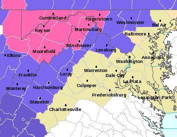
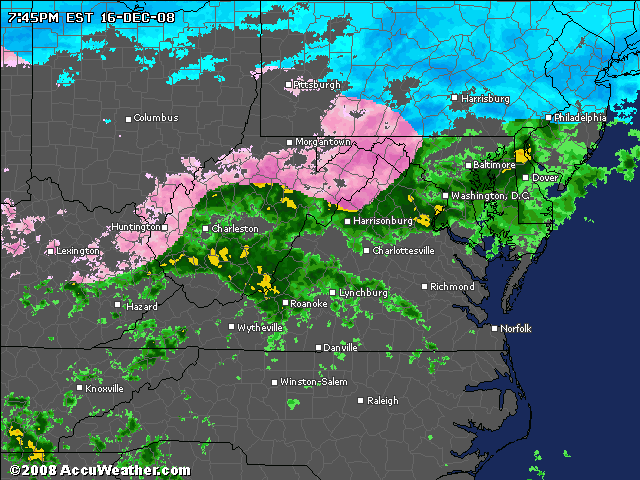
Based on my analysis of the "Nowcast" links, where I can perform a quick assessment of storm dynamics, it DOES NOT appear this will be a surprise ice storm for the Baltimore Metro region. Nor does it seem likely places like Southern Balto County, Howard, Anne Arundel or Montgomery will get any school delays out of this. Hereford Zone, Harford and Frederick might be the only ones this time. We have a classic "over-running" situation, (strong cold 1038mb high to the north, precip running over the cold air) but alas the surface/boundary layer cold air is too marginal this time. Sleet/freezing rain are "latent heat release" events, that tend to keep the temperature right at or just above 32. By contrast, snow is an evaporative cooling event, which pulls heat out of the atmosphere and thus chills it, thereby making the environment around the snow falling more conducive to producing additional snow. Despite your expectation of falling temps tonight, I think whatever they are right now will be exactly that by sunrise. That radar loop will look just about the same come morning I'll bet. A delay for all of BCPS could only occur if slightly more than half the county reporting areas observes slippery conditions by 5AM, which I doubt.
However, next week the drumbeats have already started on a major winter weather event taking shape for Saturday-Sunday. This looks to be the big kickoff I've been indicating for some time (just off on the timing!). More details about that Wednesday.