DE JA VU ALL OVER AGAIN?
Twice in the past 7 years, I've heard the famous words:
"No need for concern, the storm is going to stay mostly south of DC."
Results:
(1) January 25, 2000. Initial forecast for Baltimore: 1.5" Actual: 17"
(2) February 16, 2003: Initial forecast for Baltimore: Light rain/snow mixed. Actual: 24"
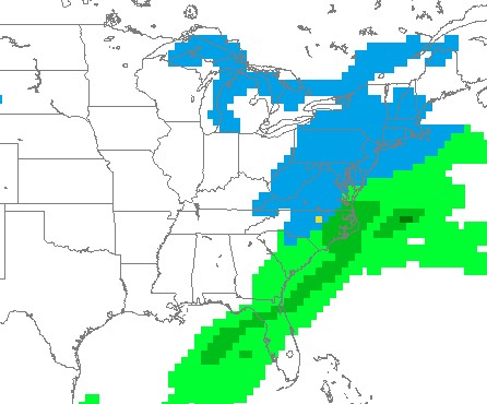
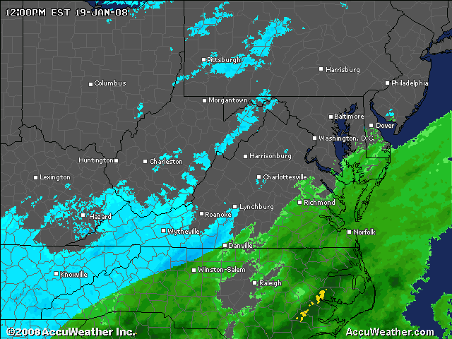
The map below was a projection by the GFS on conditional snowfall for Saturday evening. Of course no one bought this solution, because it was (and still is) believed the approaching cold front in the mid-west would kick the Southeast storm out to sea before affecting the Mid-Atlantic and Northeast. Now scroll down to see the current radar and compare. Call me a wishcaster, but it seems that the western edge of precipitation is a tad bit west of DC.