
IT WAS FUN WHILE IT LASTED
1/20/2008: Until we get to the next round of winter weather (first minor shot Tuesday, next major shot Saturday-Sunday), I wanted to share with everyone these delightful images sent to me by 2 of our readers..they're white-blooded powderhounds, and teachers in Baltimore County. If you're looking for a wintery screen saver to tide you over until next time, these are worthy candidates:
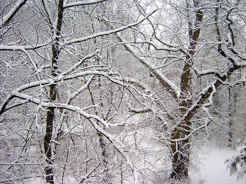
Frostry branches adorning the Hereford Zone of northern Baltimore County, MD
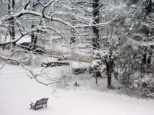
I think it's Par for course that no one will be hitting any birdies here.

Robert Frost would have been proud: "Stopping by a woods on a snowy evening..."
In case no one noticed yesterday, you went about you day underneath one of the longest-duration "vlizzards" I have ever seen. (That's a virga blizzard). I mean it snowed like mad for at least 9 hours straight, giant invisible flakes coating everything in a blanket of vapor. Actually, it was a virga storm. All that beautiful white and blue on the radar yesterday was snow falling but evaporating before reaching the ground. Whodunit? Dewpoint depression. Boundary layer moisture content was too low to be overcome, and the dryness prevented any of that snow from reaching the ground. Had it reached the surface, we could have called it a "flizzard."
Also of note is one of my personal first accomplishments with this website. After 4 years of blogging, I finally figured out ...totally by accident mind you... how to embed animation in the post. I've been wanting to show radar and satellite loops for the longest time, and as long as I can remember how I figured it out, there'll be more internet weather fun like that for you in the next storm. I'll stake out some time today to revisit our still-on-the-table Rumble Storms..the Tuesday quick shot and the Saturday-Sunday big shot.